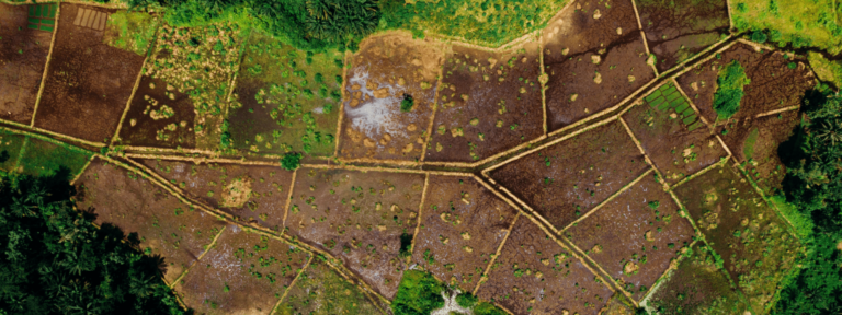
Aerial and Satellite Imagery
More frequent data powers new applications.
BENEFITS
Clearer Views
PlanetScope mosaics are created using an algorithm that selects the highest-quality imagery (i.e., cloud-free pixels) from the imagery catalog for a given interval (weekly, monthly or quarterly).
These mosaics typically have fewer clouds than any single given day of the year, and in many cases, they have no clouds at all.
Seamless Systems
Easily implemented into workflows, ready-to-use aerial and satellite imagery are already orthorectified, spectrally calibrated (where appropriate), projected and tiled.
This imagery is immediately compatible with Google Earth Engine, the Esri ecosystem and other common tools. We can also make this imagery available as a web service.
Collection Flexibility
The advantages of aerial imagery and lidar can be offset by the need for planning, mobilizing staff, meeting aircraft requirements, obtaining flight permissions and ensuring minimum flight areas (to make the entire exercise worthwhile).
Satellite imagery removes these issues and can complement existing and new aerial collections.
Approaches for using the imagery include:
- Aerial: Accurate foundational datasets collected infrequently (e.g., several years).
- PlanetScope: Broad area awareness and complete coverage collected at 3.7 meters and frequently (e.g., monthly or quarterly). These mosaics are now available with eight bands.
- SkySat: Ad-hoc 50 centimeter collection provides a balance between sufficient detail for object-based analysis and the convenience of space-based collection for an area of 25 square kilometers.
Together, these approaches provide maximum flexibility for a variety of project types and budgets.
Direct Outcomes
The temporal and spectral resolution of satellite imagery increasingly provides a reason for customers to rethink how they collect imagery. All of these sources enable us to produce timely, relevant and updated mapping that offers the most value to the end user.
Woolpert Digital Innovations is a global reseller and value-adder of Planet products, which fits well with supporting customers in planning, developing and executing projects within:
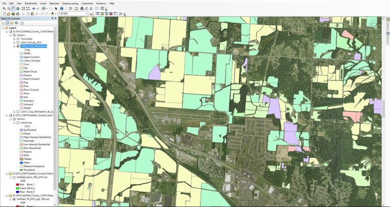
- Agriculture: State and local government crop monitoring
- Government: Post-disaster recovery
- Energy and Infrastructure: Renewable energy project design
- Forestry: Preservation and reforestation efforts
Features
Planet’s global coverage and efficient data delivery combined with our diverse geospatial expertise and relationships offer the mapping support clients want and need.
Use Planet imagery, daily imagery and mosaics by downloading, viewing in the browser or streaming via web service.
The PlanetScope mosaics now include coastal blue and additional green-, yellow- and red-edge bands, for a total of eight bands to provide full spectral discernibility and opportunities for remote sensing algorithm development.
PennDOT
Through Planet, we achieved our goals. We collected over 30 scenes across the state for the many new roundabouts constructed and new limited-access highways opened. Staff also identified scenes that captured multiple locations of interest.
Insights
Tap into our insights to gain a better understanding of our expertise, the changing landscape and how we can support your business.
The Pennsylvania Department of Transportation leverages Planet imagery to oversee...
The geospatial tool uses satellite imagery to support local governments...
Woolpert integrates its aerial mapping and remote sensing capabilities with...
The geospatial partnership will support the infrastructure and planning needs...
Contact Us
Contact Us
"*" indicates required fields


