Google recently announced two new “immersive” products for Google Maps Platform for displaying 3D map data: Aerial View and Photorealistic 3D Tiles. Both products leverage Google’s textured 3D models—which you may recognize from Google Earth—to provide real-world context and allow developers to craft unique experiences that showcase locations in 3D.
Aerial View

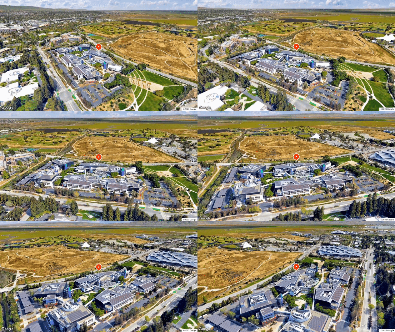
Aerial View video showing Google’s headquarters in Mountain View, CA
Aerial View videos are linked to postal addresses. Google pre-renders videos for popular locations, and developers can request Aerial View videos be generated for any locations without existing videos.
To display an Aerial View video of a location:
- Send the postal address of the location in a lookupVideoMetadata request to the Aerial View API.
-
- If the response is successful, a pre-rendered video already exists! Store the returned videoId to view the video later.
- If the response returns “Video not found”, nobody has requested an Aerial View of this location yet. Send a renderView request to generate a new Aerial View, and store the resulting videoId to view the video later.
- When you’re ready to display a video, send the videoId in a lookupVideo request to the Aerial View API to get the video URLs.
- The response will contain a list of video URLs, corresponding to different formats and landscape/portrait aspect ratios.
- Video URLs are short-lived, and Google will update videos as new data becomes available, so make a new lookupVideo request every time you want to display an Aerial View video.
- Use the URL corresponding to your desired format and aspect ratio to stream the video into your application (e.g., in an HTML <video> element).
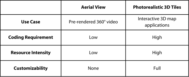
Aerial View offers a low-code way to include a 3D view of a location in your app. It’s a great fit for real estate, travel, architecture, education, and other use cases where interactivity isn’t required. And because the video is pre-rendered, it’s great for mobile devices and other resource-sensitive applications where rendering a full interactive 3D map isn’t feasible.
Photorealistic 3D Tiles
Ever wanted to build your own personal Google Earth? With this 3D offering from Google Maps Platform, you can!
Available from the new Map Tiles API, Photorealistic 3D Tiles gives developers direct access to Google’s fully-textured 3D mesh models of the world. This is the same data you might see in Google Earth, now made available via an API.

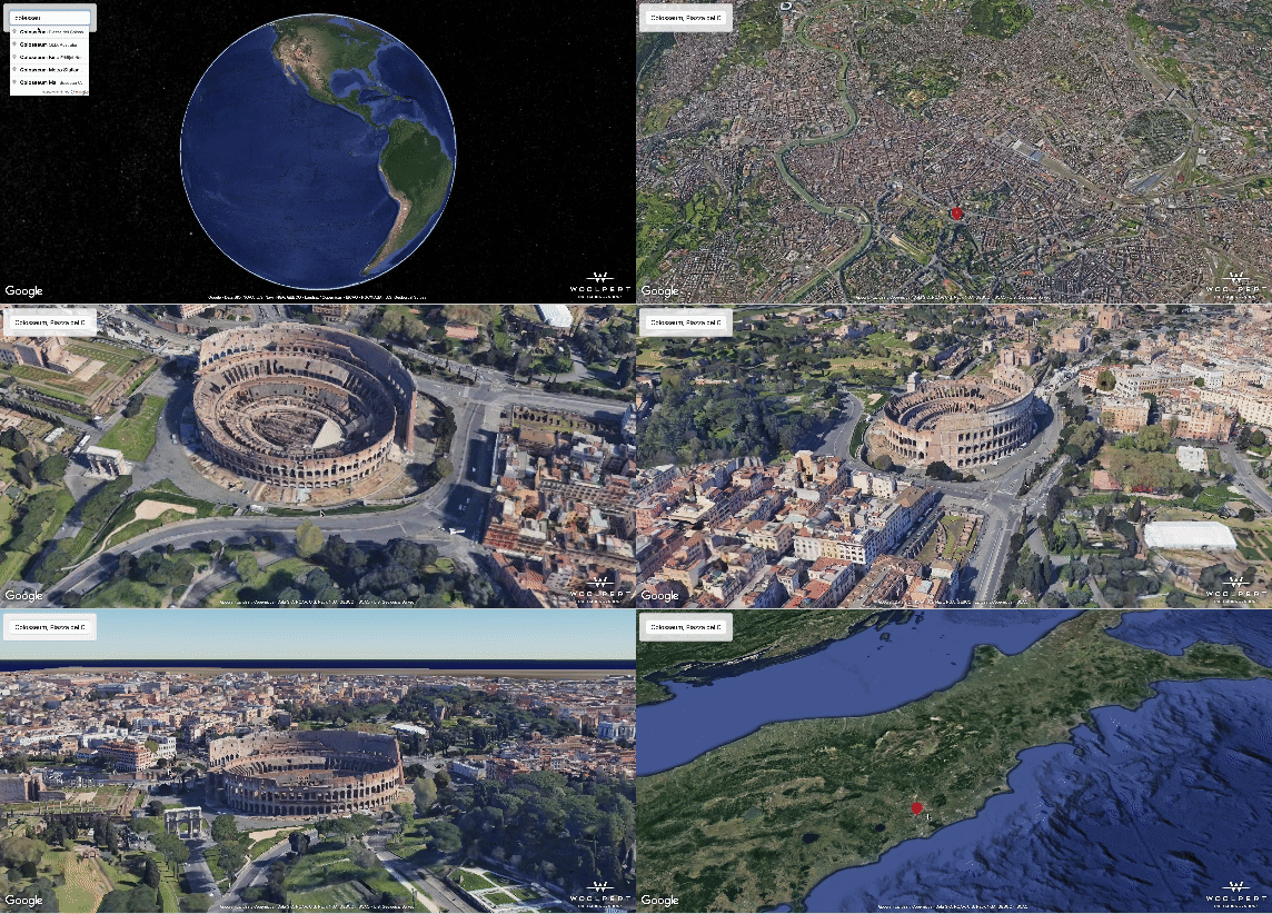
Screen recording of Woolpert 3D Tiles demo
There are many reasons this is exciting for a geo-nerd like myself. As a fan of open geospatial standards, I have to say I’m personally thrilled to see how Google is publishing their 3D data. Google didn’t invent their own API here; Google Maps Photorealistic 3D Tiles are available via an Open Geospatial Consortium (OGC) standard called (appropriately) 3D Tiles. The OGC 3D Tiles specification, originally defined by Cesium before its formal adoption as a standard, describes a hierarchy for structuring 3D data in progressive levels of detail so it can be streamed to a viewing application incrementally.
The powerful thing about 3D Tiles is that because it’s built on this open standard, you can use Google’s data to build a do-it-yourself Google Earth with your choice of map library. The OGC 3D Tiles specification is supported by a number of open-source web map libraries, including CesiumJS and deck.gl. Cesium also supports 3D Tiles in its Unity and Unreal game engine libraries. Adding Google 3D Tiles to a map that supports the OGC 3D Tiles standard is as simple as pointing your library of choice to the Tile API root tileset.
So if you’ve ever thought “I love Google Earth, I wish I could build a custom experience around that data,”—now you can! Use Google’s 3D data to make a game set in an actual city… drape data-driven visualizations over real terrain and buildings… drop the model for a planned building into its real-world surroundings. The possibilities are endless!
P.S. – Map Tiles API also provides access to 2D and Street View tiles, but that’s a topic for another blog post!
How to Choose

Use Aerial View when no interactivity is required, to show a contextual location video. It’s also useful in resource-constrained scenarios where displaying a 3D map isn’t possible.
Use Photorealistic 3D Tiles to create interactive map-centric 3D applications. Pull the data into a map library that supports the OGC 3D Tiles, or build your own custom renderer.


