hands pointing at computer screens

Geospatial
Analytics & AI

Powered By
Google Earth Engine logo
Google Vertex AI logo
Google data flow badge
Google big query badge

High-Resolution Satellite Images from Commercial Providers

The Challenge
The goal of remote sensing is to monitor and extract information about earth’s surface features at specific times and locations. However, publicly available government imagery typically lacks the high resolution needed for detailed analysis (e.g., Landsat, Copernicus Sentinels). For applications requiring information at the sub-meter level (e.g., image segmentation), publicly available data may fall short. Commercial satellite providers, on the other hand, offer imagery with higher resolutions up to 30 cm. In addition, these satellites can be tasked to collect imagery at a specific time, making them more suitable for applications requiring faster acquisitions (e.g., emergency response). However, selecting the right commercial provider and type of imagery can be challenging, as numerous commercial providers exist, each with their own data offerings and pricing structures. Furthermore, finding the right fit through trial and error can be expensive and time consuming.
The Solution

Woolpert Digital Innovations works with various commercial providers, and understands the challenge of navigating the complex landscape of high-resolution satellite imagery. We streamline this process by acting as an aggregator and collaborating with the customer to understand their use case. We then leverage our network of partners to find the optimal imagery for customer needs, as this can be challenging without established connections in the commercial satellite imagery sector.

By choosing us, customers benefit from our expertise and established partnerships, saving them valuable time and effort in finding the right imagery for their projects.

Contact Us
satellite in space
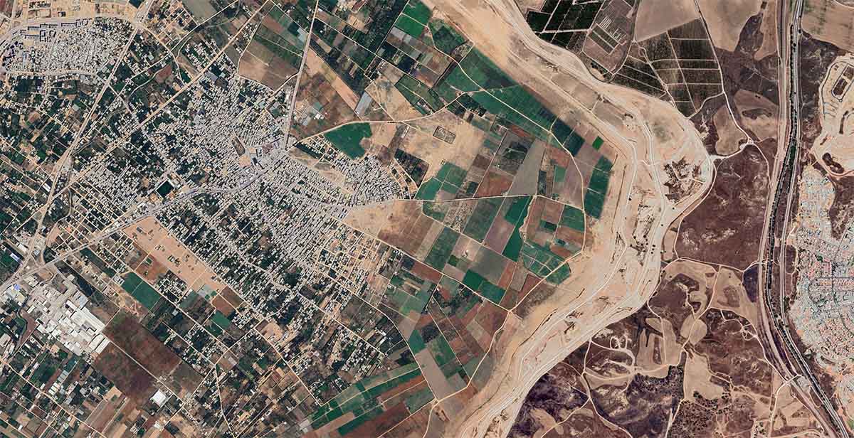
satellite image of land

Global-Scale ETL & I/O Pipelines for Earth Observations

The Challenge

A significant challenge exists when utilizing satellite imagery or earth observation data for monitoring, analytics, or AI applications. Regardless of the data source (public or private) or sensor type, significant preprocessing is often required.

This preprocessing can involve:

  • Cloud removal: Eliminating clouds to reveal the underlying features.
  • Image compositing: Combining multiple images to create a more complete picture (e.g. monthly composites).
  • Feature extraction: Generating specific data from the imagery (e.g. vegetation indices or temporal features).

Performing these tasks at scale can be extremely time-consuming and expensive, especially without a well-defined processing pipeline. Therefore, building efficient pipelines becomes crucial for handling the massive amount of data required for large-scale applications.

The Solution

We address the satellite image processing challenge by leveraging Google Earth Engine alongside other powerful GCP products like Dataflow, BigQuery, and Vertex AI. This integrated approach allows us to:

  • Effortlessly extract imagery: Obtain the necessary satellite data for projects.
  • Preprocess efficiently: Clean and prepare the imagery using automated workflows.
  • Optimize for analysis: Deliver data that's ready for advanced analytics or machine learning models.

By utilizing GCP, we can build scalable processing pipelines quickly and cost-effectively. This translates to significant time and cost savings for our customers.
Contact Us
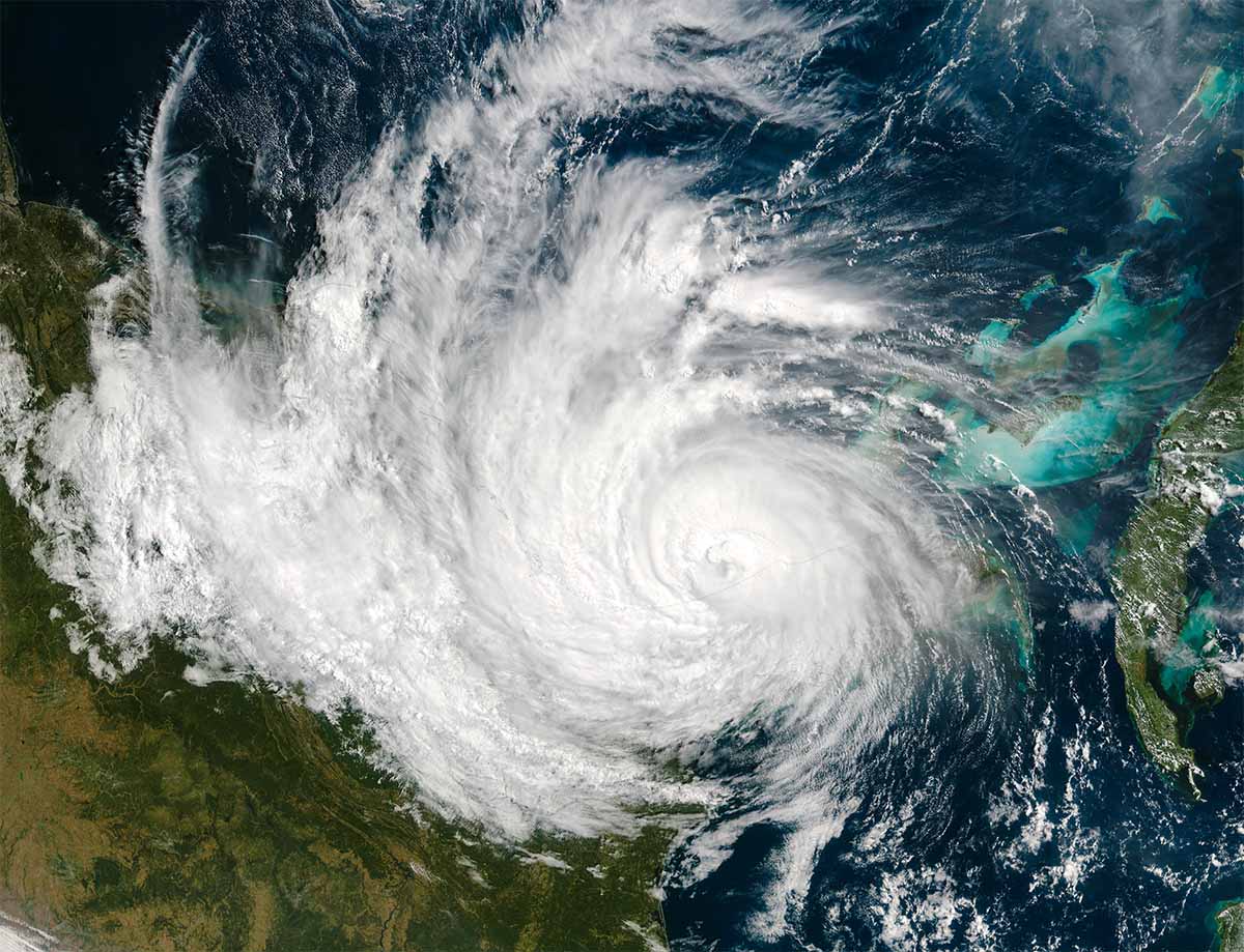
satellite view of tropical storm
satellite image of earth with lights

Bespoke Geospatial AI Models

The Challenge

Our customers might already have the satellite imagery needed. If not, we help them locate it from various commercial providers we have relationships with. Once pre-processed through our scalable pipelines, our customers are ready to unlock the power of this data.The real challenge lies in extracting custom insights specific to the customer’s unique needs. This could be because:

  • The information sought isn’t readily available elsewhere.
  • A customer possesses proprietary training data that can’t be shared publicly.

Here’s where we come in. We help customers build custom AI models tailored to specific use cases, transforming raw satellite imagery into actionable, informative insights.

The Solution

Our solution leverages Vertex AI, Google’s AI platform, along with our expertise in artificial intelligence. This enables us to build custom models that tackle specific challenges for our customers. These models extract unique information highly relevant to a particular situation. Examples of how this works include computer vision models:

  • These models can automatically detect and extract objects or features from imagery. This could be anything from identifying buildings in a city to counting specific types of trees in a forest.
  • Classification models: These models are useful for classifying different types of land cover or land use. For example, they can be used to track changes in the crop type planted by farmers or the expansion of urban areas.
  • Predictive models: These models go beyond simple detection and estimate real-world values. For example, a customer can estimate crop yield for a specific region or assess the risk of flooding or drought in a particular area.

Leveraging Google Cloud’s AI suite of products, our team of AI experts and data scientists offer completely customized modeling solutions from data ETL to model deployment and inference.

Contact Us
graphic of a map
computer circuits and board
End-To-End Cloud-Based Geospatial AI Pipelines
The Challenge
A well-designed ETL pipeline, an accurate and scalable model, and a fast inference pipeline are all crucial elements of a robust AI pipeline. However, for most customers, the real challenge lies in integrating these elements into a single, end-to-end AI platform. For example, an early-stage startup with a great AI product prototype may not have a dedicated engineering team to help scale to production, and making the power of AI accessible to customers and building a user-friendly platform isn’t as simple as it seems. This requires balancing powerful back-end functionality with a clear, intuitive interface for users of all technical backgrounds. The platform also needs to integrate seamlessly with various components and prioritize user data security. Ongoing maintenance adds another layer of complexity. This is why having experienced developers and UI/UX designers is crucial for creating a successful platform.
The Solution
Building a complete geospatial AI solution can be daunting, especially without a dedicated engineering team. With our help, customers can unlock the power of AI for satellite image analysis without the burden of building and maintaining complex infrastructure. We can bridge the gap between data and actionable insights, propelling any project forward.
Contact Us
hand holding smart phone with graphics on top of phone
dots and lines
Image
Dylan Murphy, Co-President and COO of Backhaul Direct

“The support we’ve received from Woolpert has been outstanding. From the start, we’ve been able to reach out with any issues, and they’ve always been resolved quickly. Their expertise made integrating Google Maps into our TMS seamless.”

> Read More
Image
Tyler Barras, Global GIS Manager, Data Strategy at JLL

“The ongoing relationship with Woolpert Digital Innovations has been excellent. They’ve been responsive and helpful with everything we’ve needed, which has led to achieving significant cost savings.”

> Read More
Image
Ori Elkin, Head of Product and Engineering

“Google Earth Engine’s scalable and cloud-based technology helps us build reliable outputs, cutting-edge solutions, and long-term partnerships with crop insurers in a reliable and interactive way.”

> Read More
Image
Mike Koleno, Chief Technology Officer, Better Trucks

“With a proven track record of building digital solutions, Woolpert Digital Innovations brings a wealth of experience and knowledge that aligns perfectly with our technology program’s requirements, ensuring successful implementation and maximizing value delivery. Their expertise in integrating these technologies has been crucial for our project’s success, leading to innovative solutions and improved efficiency.”

> Read More
Image
Théophile Adenot, Co-Founder and Chief Technology Officer, Ynstant

“Working with Woolpert has enabled us to dramatically improve the experience we offer our users, while mastering the use of Google products.”

> Read More
Image
David Sullivan, Founder and CEO at Ziip

“Woolpert’s highly skilled and trained team possesses a deep understanding of real-world applications and business acumen, contributing to their success. Moreover, from our collaboration with every member of their team, they have been accommodating, attentive, and congenial to work with, further enhancing the overall experience.”

> Read More
Image
Chirag Mital, Director of Data Science, Revel Transit

“Woolpert Digital Innovations & Google’s ODRD service has elevated Revel’s core technical capabilities in scaling our all-electric rideshare business. It has had a dramatic impact on both the end-user app experience and the efficiency of our internal optimization algorithms.”

> Read More
Image
Frank DeSendi, Planning Division Manager

“Through Planet, we achieved our goals.”

> Read More
Image
Daniel Moore, Founder & CEO

“Being able to integrate Google Maps into our platform was a natural feel for someone to grow accustomed to. So the learning curve was much smaller.”

> Read More
Image
Alex Schittko, Information Technology Manager

“The second a customer sees that the product uses Google Maps, you can feel a sense of relief.”

> Read More
Image
Bo Lowery, Director of Marketing

“You can’t run your business without Google Maps these days and tapping into Google’s best practices.”

> Read More
Image
Ben Jones, CEO

“What interested us was Google being the dominant map company in the U.S., or the globe for that matter. For us, as a startup at that point, we were looking for scalability and accuracy and went with someone who already had that and proved it out.”

> Read More
Image
Chris Shirer, President and Chief Strategist

“We chose Google Maps and Google Maps APIs to do it because Google offers a familiar interface for our customers, lets us layer custom information on top of maps and provides a platform that will allow us to add new features, like delivering relevant, location-based ads.”

> Read More
Image
Travis Jones, CEO

“It was pretty cut and dry from the standpoint of why we would choose Google Maps over all the other mapping options that are currently available in the market. To be frank, other map solutions just don’t stand up to Google.”

> Read More
Image
Dan McManus, President and CEO

“When we have software demonstrations and talk about field service, Google Maps is a huge part of that story.”

> Read More
Image
Michael Lovett, Co-founder and CEO

“Our map-based web app shows vending operators where their machines are located, which need service, and how much cash is waiting. It also helps build super efficient driver routes.”

> Read More
Image
Bolivar Bravo, Head of Mobile Engineering

“With Google Maps, we’ve been able to very easily build a website and mobile apps that let people quickly find a nearby Staples store and get directions to it.”

> Read More
Image
Alex Popof, CEO

“Everyone knows Google Maps, so it was a natural fit as a unique feature.”

> Read More
Image
Robin de Bled, Senior Developer, Network Ninja

“Google Maps is an absolutely integral part of our application and our business. It’s easy to work with, robust, full featured and has awesome support from Woolpert Digital Innovations when we need it.”

> Read More
Image
Matt Knapp, Director of Product Development

“There is no way we could have done it without an automated solution.”

> Read More
Image
Katie Sheppard, Director of Marketing

“I’m not a tech guru. Using Google was so nice because I didn’t have to learn something new. I could do it quickly then be able to train someone else easily.”

> Read More
Image
John Keene, Founder

“These things grouped together create a competitive advantage for our product because you can now outsource call handling, maximize your schedule efficiency and create a more natural call flow. This is enabled by the fact that we built everything on top of Google Maps Platform.”

> Read More
Image
François de Landes, COO and Co-founder

“We would not be able to function as a business if we did not use Google Maps.”

> Read More
Image
Shreya Batra, Senior Product Manager

“Woolpert Digital Innovations provides us with support all the time, and it’s been excellent.”

> Read More
Image
Frederic Dubois, Senior Product Manager

“As far as usability, A+. Everyone knows Google Maps.”

> Read More
Image
Melissa Turner Fortenberry, Vice President of Product

“Part of our product strategy is to focus on what we are great at—and that’s building internet marketplaces. But, ingrained in that is making sure we have partners who are great at what they do and can grow and scale with us. It was a really easy decision for us to go with Google.”

> Read More
Image
Jeremy Gelbart, Co-Founder and CEO

“We cannot imagine Autobrain without Google. At the core level, it is integrated with what we do.“

> Read More
Image
Xuan Zhang, CTO

Google Cloud makes developing much easier for our team and is nicer to use [than competitors].”

> Read More
Image
Ashleigh Iriving, Marketing Director

“In this day and age, everybody is on their phone and everyone is familiar with Google Maps to navigate wherever you’re going. So what we wanted to do was create something similar on property for guests.”

> Read More
Image
Paul Falbe, IT Director

“This trucking company is pretty sophisticated, but any time we can do something more efficiently, we do it. That’s why we partner with Woolpert for Google Maps.”

> Read More
Image
Antonio Arocha, CEO

“Woolpert Digital Innovations has been nothing but great, responsive and incredibly supportive partners. We couldn’t do what we do without them.”

> Read More
Image
Brittany Suszan, Vice President Market Development

“In terms of mapping products, Google Maps Platform outperforms the others. When finding a location, they provide the most accurate and up-to-date data which is crucial to our work.”

> Read More
Image
Ignacio Carrillo-Batalla, Chief Technology Officer

“Over time, you’ll need access control, to be able to store more gigabytes of data, and to operate more efficiently, and I think that won’t be possible without Woolpert and Workspace.”

> Read More
Image
Alok Ahuja, CEO and Co-founder

“Woolpert Digital Innovations was recommended to us by Google because we had infrastructure issues and questions around fleet optimization. Our team benefits from their expertise in mobility and premium customer support.”

> Read More
Image
Erik Ostebo, IT Manager

“Google Workspace makes it easy to support 130 users on my own, which can be extremely difficult, but with the combined efforts of Woolpert’s support, I have a wide range of capabilities.”

> Read More
Image
Aleksey Denysyuk, Co-Founder

“Using Woolpert Digital Innovations’ expertise in mobility solutions, we can deliver a unique, customer-centric experience and disrupt the market with Google Maps Platform. VanOnGo’s mission is to transform logistics from a traditional cost function into a business growth and delivery experience.”

> Read More
Image
Alok Ahuja, CEO & Co-Founder

“Woolpert Digital Innovations was recommended to us by Google because we had infrastructure issues and questions around fleet optimization. Our team benefits from their expertise in mobility and premium customer support.”

> Read More
Image
Noureddine Tayebi, CEO

“We wouldn’t have a service if we didn’t have Google Maps, simple as that.”

> Read More
Image
Cecil Helton, Digital MArketing Manager

“Our partnership with Woolpert Digital Innovations is all we can ask for thus far because we do business with the best.”

> Read More
Image
Sara Lane Bui, Senior Manager of Brand & Digital Strategy

“Implementing a location solution was key for our business plan, and finding the right partner created a better experience around our Google relationship thanks to Woolpert Digital Innovations.”

> Read More
Image
Gary Graham, Application Analyst at 9Rooftops

“The collaboration has been exceptionally easy. Woolpert demonstrated proactive support, particularly in troubleshooting billing issues.”

> Read More
Image
Ignacio Carillo-Batalla, Chief Technology Officer

“By partnering with Woolpert Digital Innovations, we are able to utilize Google Maps Platform more efficiently and ensure that our drivers know exactly where they are going and how to get there. And it’s a win for our customers who get their rides faster.”

> Read More